Landmark Identification
If these last two methods were unsuccessful you may want to use a resource named Overpass Turbo. The platform centers around tagged landmarks in a geographic area. Landmarks can include natural features (like mountains or rivers), historical sites, monuments, buildings, types of businesses and other structures that are differentiated by cultural, historical, or aesthetic purposes. Overpass Turbo is designed to create and run queries on OpenStreetMap, a collaborative, volunteer generated geographic database that has been tagging these types of landmarks for over 20 years.
✺
In addition to volunteer tagging, the database also pulls from infrastructural public datasets and aerial imagery. Overpass Turbo runs on the Overpass API query language to search for an extremely wide array of different built and natural environmental features.
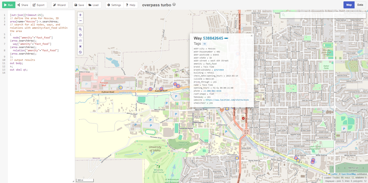
For example, here is a map I created of all of the landmarks identified of fast food “amenities” here in Moscow. Click here to explore. (It may take a moment to load.)
✺
When geolocating with landmarks, it’s essential to consider if you have enough reference points to accurately identify a location. In triangulation you have (you guessed it) three points of reference that you can use to measure angles and distances between landmarks to identify an area. These points of reference can be landmarks or distinctive elements of the skyline.
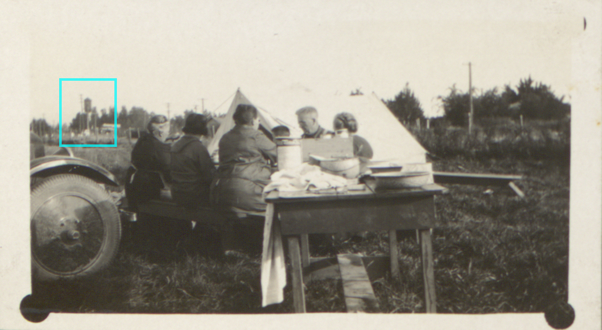
Take this photo from the scrapbook collection for instance. Because this photograph is located in the scrapbook between two others we can identify as Yellowstone National Park, there’s a good chance it is as well.
Using the following code, we can search this area for the water tower we see on the left.
[out:json][timeout:25];

// Define the bounding box for the area around Yellowstone National Park
(
  node["man_made"="water_tower"](44.0030,-111.2045,45.0030,-109.2045);
);

// Output the results
out body;
>;
out skel qt;
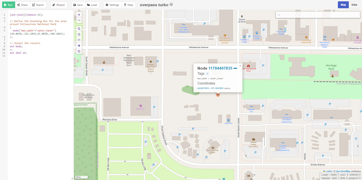
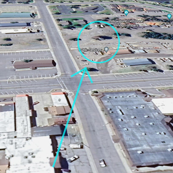
While we find that there is a water tower located within an area that would likely have had the power line we see running across the block in the background, there aren’t enough landmarks or clearly visible landforms in the background of the image to orient us in space.
✺
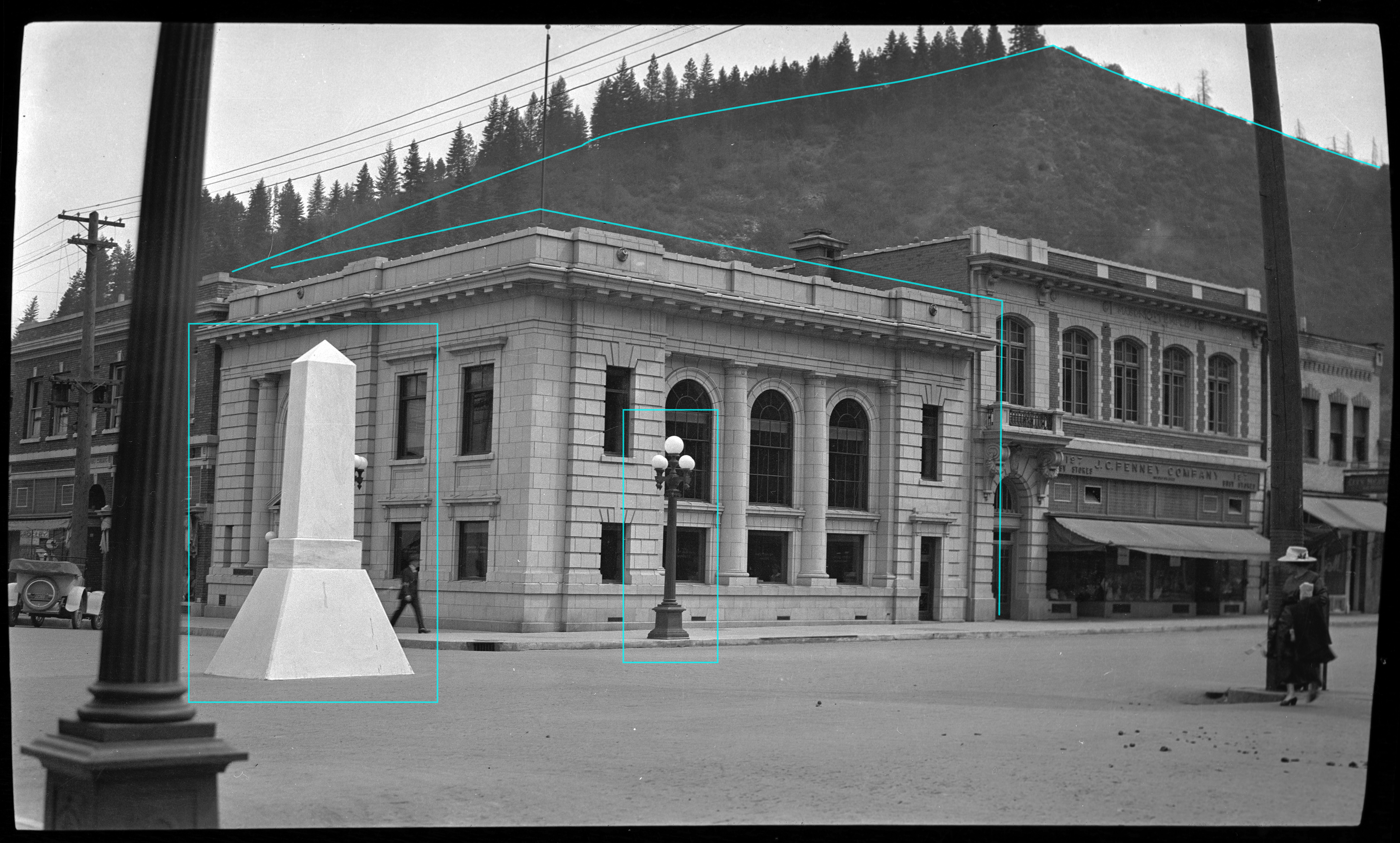
In contrast, this photograph would be an example of an image that is ideal for triangulation (setting aside the fact that we actually know this is located in Mullan, Idaho). We have a monument in the road, a series of street lamps, a structure that resembles a 19th century bank and a landform in the background with a fairly distinct shape.
Using the OpenStreetMap language again, we can search for these elements within the state of Idaho:
[out:json][timeout:25];
// Define the area of Idaho using its boundary
area["admin_level"="4"]["name"="Idaho"]->.searchArea;

// Query for street lamps
(
  node["highway"="street_lamp"](area.searchArea);
  way["highway"="street_lamp"](area.searchArea);
  relation["highway"="street_lamp"](area.searchArea);
);

// Query for monuments
(
  node["historic"="monument"](area.searchArea);
  way["historic"="monument"](area.searchArea);
  relation["historic"="monument"](area.searchArea);
);

// Query for banks
(
  node["amenity"="bank"](area.searchArea);
  way["amenity"="bank"](area.searchArea);
  relation["amenity"="bank"](area.searchArea);
);

// Output the results
out body;
>;
out skel qt;
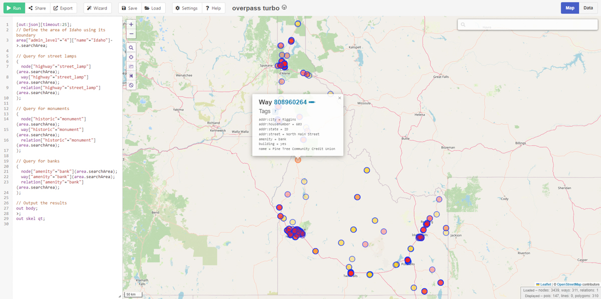
The map this code generates is indicative of some of the shortcomings OpenStreetMaps has as a collaborative, volunteer driven platform: just because there is a tag for a type of landmark doesn’t mean that there will be consistent data for it. While there are 3439 banks identified here, we have no monuments or street lamps and even the bank in Mullan isn’t tagged. Overpass Turbo excels in densely populated areas, but it tends to be less reliable in rural regions, often resulting in significant data gaps for many landmarks.